Log in
All resources
Create a design
4,430 Free Artworks of Maps With View Images
arnold's geographical handbook (1899)
maps in the library of congress
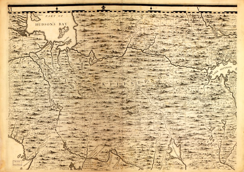
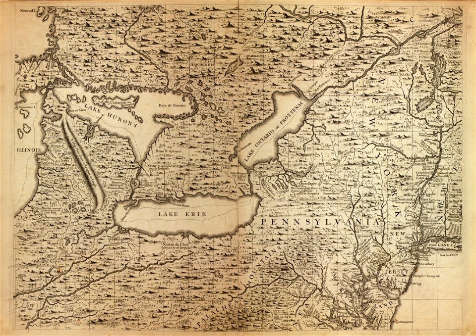
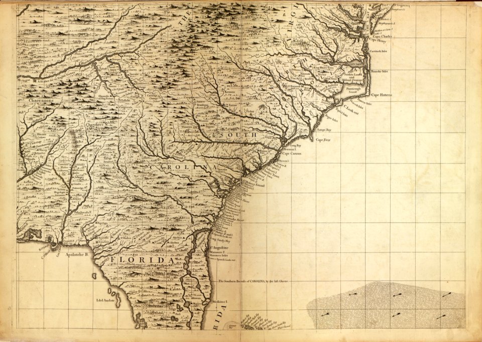
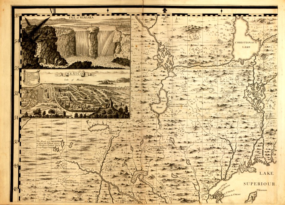
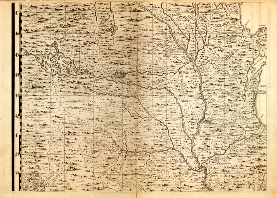
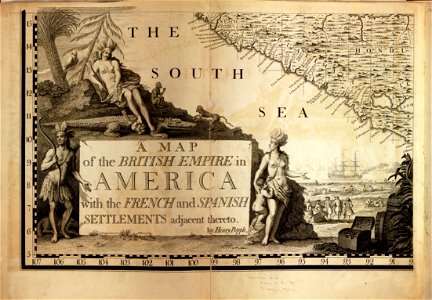
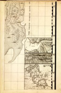
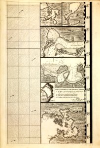
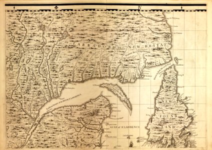
a map of the british empire in america with the french and spanish settlements adjacent thereto
maps from the earth and its inhabitants, vol. iv
1899 maps of the united kingdom
1899 maps of south america
maps from the earth and its inhabitants, vol. xiii
charles eugène perron
maps from the earth and its inhabitants, vol. xvii
19th-century maps of kent
maps from the earth and its inhabitants, vol. x
john hanning speke
maps from the earth and its inhabitants, vol. iv
sewers in london
maps from the earth and its inhabitants, vol. xvi
19th-century maps of mexico city
maps from the earth and its inhabitants, vol. xiii
old maps of luanda
maps from the earth and its inhabitants, vol. iv
eddystone rocks, devon
maps from the earth and its inhabitants, vol. xiv
exploration of australia
maps from the earth and its inhabitants, vol. v
ringkjøbing
maps from the earth and its inhabitants, vol. vi
maps of kerch
maps from the earth and its inhabitants, vol. xviii
south america in the 19th century
maps from the earth and its inhabitants, vol. iv
lowestoft
maps from the earth and its inhabitants, vol. xiii
maps of journeys
maps from the earth and its inhabitants, vol. vii
charles eugène perron
mining in south africa
maps of vaal river
maps from the earth and its inhabitants, vol. iv
snaith
maps from the earth and its inhabitants, vol. xvii
linguistic maps of north america
maps from the earth and its inhabitants, vol. xvii
1870s maps of florida
maps from the earth and its inhabitants, vol. iv
isle of thanet
19th-century maps of senegal
orientalist painting
maps from the earth and its inhabitants, vol. ix
darah nur
maps from the earth and its inhabitants, vol. xvii
archaeological sites in ohio
old maps of lake titicaca
maps of lake titicaca
19th-century maps of senegal
orientalist painting
maps from the earth and its inhabitants, vol. v
charles eugène perron
maps from the earth and its inhabitants, vol. vii
yarlung tsangpo
maps from the earth and its inhabitants, vol. viii
british raj
prints of cartouches in the rijksmuseum amsterdam
maps in the rijksmuseum amsterdam
maps from the earth and its inhabitants, vol. iv
old maps of the isle of arran
maps from the earth and its inhabitants, vol. iv
old maps of edinburgh
maps from the earth and its inhabitants, vol. iv
old maps of newcastle upon tyne
maps from the earth and its inhabitants, vol. iv
old maps of lindisfarne
maps from the earth and its inhabitants, vol. iv
19th-century maps of kent
maps from the earth and its inhabitants, vol. iv
1870s maps of london
maps from the earth and its inhabitants, vol. iv
old maps of leeds
maps from the earth and its inhabitants, vol. iv
maps of the humber estuary
maps from the earth and its inhabitants, vol. iv
old maps of edinburgh
maps from the earth and its inhabitants, vol. iv
old maps of hastings, england
juan francisco leonardo (1687) mapa del arzobispado de toledo
historical images of alcalá de henares
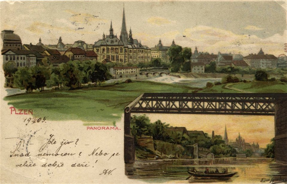
postcards by erwin spindler
postcards of plzeň
a map of the british empire in america with the french and spanish settlements adjacent thereto
maps in the library of congress
a map of the british empire in america with the french and spanish settlements adjacent thereto
maps in the library of congress
a map of the british empire in america with the french and spanish settlements adjacent thereto
maps in the library of congress
a map of the british empire in america with the french and spanish settlements adjacent thereto
maps in the library of congress
a map of the british empire in america with the french and spanish settlements adjacent thereto
maps in the library of congress
a map of the british empire in america with the french and spanish settlements adjacent thereto
maps in the library of congress
a map of the british empire in america with the french and spanish settlements adjacent thereto
maps in the library of congress
a map of the british empire in america with the french and spanish settlements adjacent thereto
maps in the library of congress
a map of the british empire in america with the french and spanish settlements adjacent thereto
maps in the library of congress
a map of the british empire in america with the french and spanish settlements adjacent thereto
maps in the library of congress
a map of the british empire in america with the french and spanish settlements adjacent thereto
maps in the library of congress
a map of the british empire in america with the french and spanish settlements adjacent thereto
maps in the library of congress
a map of the british empire in america with the french and spanish settlements adjacent thereto
maps in the library of congress
a map of the british empire in america with the french and spanish settlements adjacent thereto
maps in the library of congress
a map of the british empire in america with the french and spanish settlements adjacent thereto
maps in the library of congress
a map of the british empire in america with the french and spanish settlements adjacent thereto
maps in the library of congress
nouveau cours d'instruction primaire de géographie (1886)
maps of tahiti
arnold's geographical handbook (1899)
old maps of lanarkshire
arnold's geographical handbook (1899)
1899 maps of the caribbean
arnold's geographical handbook (1899)
1899 maps of italy
arnold's geographical handbook (1899)
1899 maps of the world
arnold's geographical handbook (1899)
1890s maps of south africa
arnold's geographical handbook (1899)
1899 maps of south america
arnold's geographical handbook (1899)
1890s maps of oceania
arnold's geographical handbook (1899)
1899 maps of the united kingdom
arnold's geographical handbook (1899)
1890s maps of scotland
arnold's geographical handbook (1899)
1899 maps of south america
a school geography (1898) by bird
old maps of hong kong
arnold's geographical handbook (1899)
1899 maps of the caribbean
arnold's geographical handbook (1899)
1899 maps of the caribbean
arnold's geographical handbook (1899)
1899 maps of the united states
arnold's geographical handbook (1899)
1899 maps of the united kingdom
arnold's geographical handbook (1899)
1899 maps of the united kingdom
arnold's geographical handbook (1899)
1899 maps of the united states
arnold's geographical handbook (1899)
1899 maps of europe
arnold's geographical handbook (1899)
1899 maps of russia
arnold's geographical handbook (1899)
1890s maps of ireland
arnold's geographical handbook (1899)
1890s maps of scotland
a school geography (1898) by bird
1898 maps of new york city
arnold's geographical handbook (1899)
1899 maps of the united kingdom
arnold's geographical handbook (1899)
1899 maps of germany
arnold's geographical handbook (1899)
1899 maps of asia
arnold's geographical handbook (1899)
19th-century maps of scandinavia
arnold's geographical handbook (1899)
1899 maps of south america
arnold's geographical handbook (1899)
1899 maps of the united kingdom
arnold's geographical handbook (1899)
19th-century maps of the americas
arnold's geographical handbook (1899)
1899 maps of france
arnold's geographical handbook (1899)
1899 maps of the united kingdom
arnold's geographical handbook (1899)
1899 maps of the ottoman empire
arnold's geographical handbook (1899)
1899 maps of africa
arnold's geographical handbook (1899)
1899 maps of india
arnold's geographical handbook (1899)
1899 maps of europe
arnold's geographical handbook (1899)
1899 maps of the united kingdom
arnold's geographical handbook (1899)
1899 maps of south america
arnold's geographical handbook (1899)
1899 maps of south america
arnold's geographical handbook (1899)
1899 maps of the united kingdom
arnold's geographical handbook (1899)
1890s maps of new zealand
arnold's geographical handbook (1899)
1899 maps of europe
arnold's geographical handbook (1899)
1899 maps of south america
arnold's geographical handbook (1899)
1899 maps of africa
arnold's geographical handbook (1899)
1890s maps of canada
arnold's geographical handbook (1899)
1890s maps of scotland
1001 - 1100 of 4,430
Next page
/ 45